What this gallery contains, and what it cannot contain
| This gallery contains | This gallery does not contain |
|---|---|
| Indicative visualisations built from the circulating specifications and our own density arithmetic | Photographs of the site, of a show apartment or of any built structure on this parcel |
| Corridor geometry taken from verified public map data — roads, villages, highway alignments, distances by road | A surveyed site boundary, a survey number or anything that fixes the parcel's edges |
| An indicative layout diagram | A sanctioned master plan, or any drawing stamped by a planning authority |
| Interior scenes drawn at our estimated unit sizes | Approved floor plates, dimensioned rooms or a specification schedule |
Three consequences follow, and they govern every scene below.
Nothing here is a specification. The land area, the home count, the tower count, the floor count and the unit sizes are either information circulating ahead of launch or our own estimates with the arithmetic shown. The visualisations inherit every one of those uncertainties, including the largest: whether this parcel carries about 1,000 apartments, as the corridor's own density implies, or the 1,500-plus in circulation, which reads as a whole-holding figure across more than one phase.
No image changes the regulatory position. Goyal Soukya Road is not registered with Karnataka RERA. A filter of the K-RERA registry on the Hoskote taluk code 1250/304 returns 224 registrations current to 28 July 2026, and there is no registration for this apartment development. Under Section 3 of the Real Estate (Regulation and Development) Act 2016 a project of this size may not lawfully be advertised, booked or sold until it is registered, so no booking amount, allotment letter or agreement to sell can be executed until a number is issued. Verify at rera.karnataka.gov.in. A Karnataka project registration takes the form PRM/KA/RERA/.../PR/....
The pin is not the parcel. The coordinates this site publishes, 12.98484 N and 77.78384 E, are the OpenStreetMap village node for Thirumalashettihalli. We hold no survey number and no site boundary. Every map view here is corridor-representative and should be read as "somewhere in this belt", not "here".
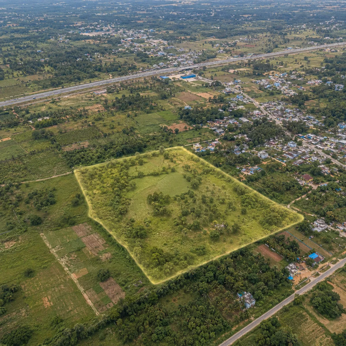
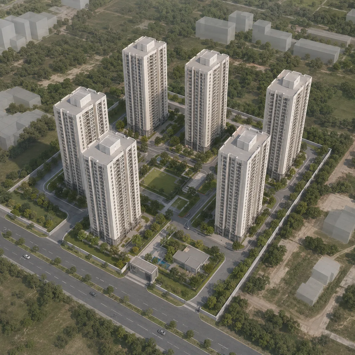
Aerial: the parcel between Thirumalashettyhalli and Samethanahalli
What the view shows. The belt from above. Soukya Road runs east to west across the frame — the Hope Farm to Chikka Tirupathi axis, 9.7 km from the western junction to the road's eastern end, with a further 20.1 km on to Chikkatirupathi. This is not the Whitefield to Hoskote road; that is SH-35, a separate corridor running north from the same junction, about 3.4 km away in a straight line. West to east the villages sequence as Channasandra, Thirumalashettyhalli, Koralur, Samethanahalli, Bodana Hosahalli, Kacharakanahalli, Dodda Dunnasandra and Bisanahalli, and the parcel described in circulation sits in the Thirumalashettyhalli to Samethanahalli stretch. Off one edge of the frame, less than a kilometre away in a straight line, runs the NH-648 alignment of the Satellite Town Ring Road. About 2 km north-east of the village node this site publishes — 3.5 km by road, because the campus sits off Soukya Road itself — is the roughly 30-acre organic-farm campus of SOUKYA, the holistic health centre that gives the road its name.
What a buyer should look for. First, understand what the aerial cannot tell you. It cannot show the parcel's boundary, because no boundary is held — an aerial with a crisp red outline on it is asserting something nobody has published. Second, look at the grain of what surrounds the site: this is a village belt with agricultural land, small clusters of houses and a small number of large gated schemes, not a continuous suburb. That is what 12 acres of high-rise would be inserted into. Third, look at the road width where the frontage would be. Soukya Road here is a modest two-lane road, and we could locate no source covering a widening programme for Soukya Road or its western continuation — a scheme of about 1,000 homes puts a great deal of traffic onto a road that has not been shown to be getting any wider.
The infrastructure caveat that belongs in this view. NH-648 passing 0.78 km away in a straight line is the corridor's largest structural advantage, and it is routinely understated by an order of magnitude on other pages. But the section that runs past this belt, from Hoskote to the Tamil Nadu border, was not open in the most recent reporting we could verify: 20.25 km of 20.9 km built, blocked by a roughly 650 m gap at a rail overbridge, targeted for June 2026 after a slip of about sixteen months. Whether that gap has since closed is the single fact on this corridor most worth checking on the day you visit. No aerial view settles it.
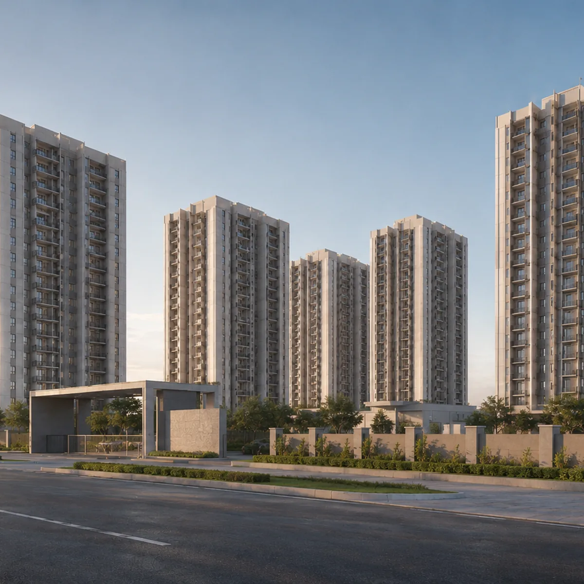
Exterior: six towers, and why the count is arithmetic rather than a plan
What the view shows. The scheme's massing from the road side — six residential towers on an indicative two basements plus ground plus 24 upper floors, standing on a 12-acre parcel. Every one of those numbers is derived rather than announced. About 1,000 homes across six towers is 167 a tower; 167 over 24 upper floors is 6.9, which rounds to seven homes on a typical plate — an ordinary two- and three-bedroom core-and-corridor layout. The cross-check against the corridor is that Provident Botanico runs about 142 homes a tower across nine towers, so six towers of 167 sits in a normal range rather than an exotic one.
What a buyer should look for. Count the floors in the image and hold that count against whatever a future drawing says; render floor counts and specification floor counts diverge more often than they should. Look hard at the spacing between towers, because tower-to-tower distance is the privacy and daylight question on a 12-acre site and it is the first dimension squeezed when a home count rises. Look at which faces address Soukya Road and whether those elevations are treated differently. And look at balcony depth, which reads generously in every visualisation ever made and is decided by a dimension on a drawing.
One number you will not find here. This site publishes no building height in metres, for this or any view. None is derivable from anything we hold, and a height figure invented to make an elevation look authoritative is exactly the kind of number that becomes permanent once it is published. If a height appears at launch, ask which drawing it comes from and whether any aerodrome height clearance applies.
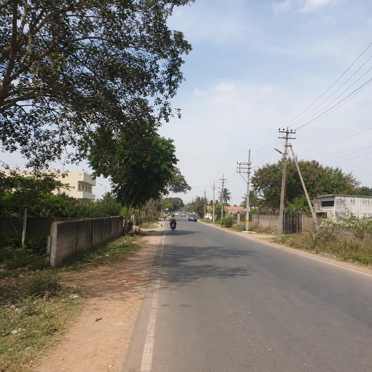
Arrival: the gate, the drop-off and the road outside it
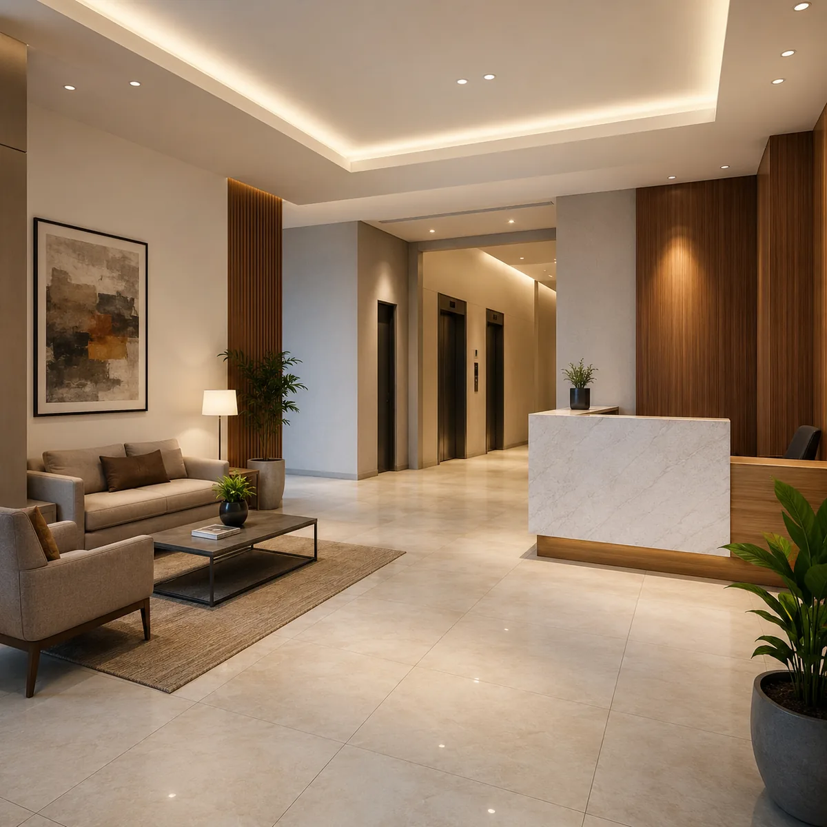
What the view shows. The entry sequence at eye level — the boundary and gate on Soukya Road, a controlled drop-off court, the basement ramp mouths, and a lobby beyond. This is the scene closest to the daily experience of living somewhere and the one pre-launch galleries most often skip in favour of a pool at dusk.
What a buyer should look for. Start with the queue. About 1,000 households produce a real morning and evening peak, and the entry is where it lands. Ask how many gates there are, whether entry and exit are separated, whether visitor verification happens off the carriageway, and whether the drop-off court is deep enough that cars waiting to enter do not stand on Soukya Road itself. Then look at the walk. Is there a footpath from the gate to the towers that does not share a surface with cars? Where does a school bus stand at 7:30 in the morning, and can three of them stand there at once?
What the corridor adds to this view. Search demand around this belt runs through phrases like soukya road whitefield bangalore, and the Whitefield framing sets an expectation of pavements, streetlights and shops at the gate. The reality at Thirumalashettyhally is a village-scale frontage 4.5 km east of Hope Farm junction and about 6.9 km from ITPL by road, with the nearest Purple Line metro station 5.1 km away by road. An arrival visualisation shows the inside of the gate. Stand outside it before you decide.
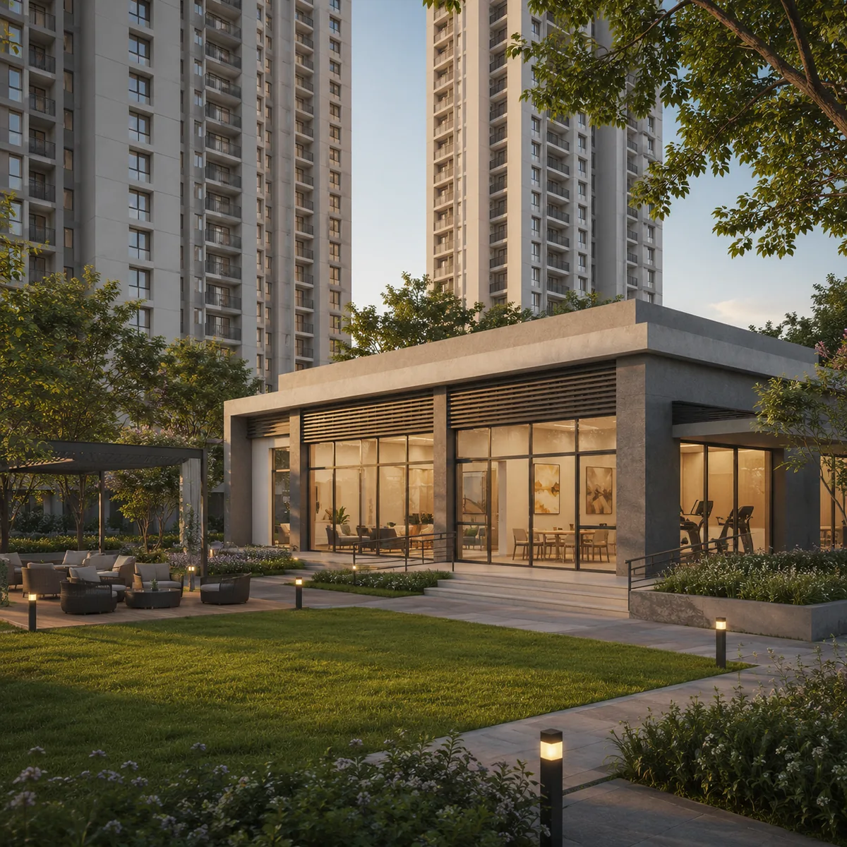
Clubhouse: the view with the least evidence behind it
What the view shows. A clubhouse — an entrance, a double-height volume, a gym floor, an indoor games area, a hall. For a scheme of about 1,000 households this is the building that decides whether there is a community centre or none.
What a buyer should look for. Treat this scene as the most speculative on the page, because no clubhouse has been announced for this project: no area, no level count, no facility list. We publish no clubhouse area in square feet here, and we could not obtain a published clubhouse area for any priced comparable on this road either, so there is no honest benchmark to hold a future figure against. What you can do is ask the three questions a render never answers. Is it a standalone building or a floor inside a tower? Is it handed over with the first tower or the last? And how many households are entitled to it — because at this scale the answer is the whole number, not a phase.
The nearest thing to evidence on this corridor comes from the finished scheme next door. Birla Alokya's own material describes 218 villaments and one clubhouse on 7.9 acres. That is a far softer ratio than a 1,000-home apartment community will produce, and it is worth seeing in person precisely because it sets a realistic upper bound on what a clubhouse on this road feels like when it is full.
Pool: the deck scene, and the water question underneath it
What the view shows. A pool deck, loungers, planting, towers behind. It is the single most reproduced image in Indian pre-launch marketing and the one that carries the least information.
What a buyer should look for. Ask where the water comes from. This is the section of the gallery where a pretty scene runs straight into a hard corridor fact: Cauvery Stage V does not reach this parcel. That scheme serves the 110 villages added to BBMP, and these villages are in Hoskote taluk, outside BBMP. The realistic base case here is borewell supply with tanker top-up, for the pool, the landscape and the 1,000 households at the same time. A community of this size at ordinary Indian domestic planning figures would need something on the order of several hundred kilolitres of water a day — a demand estimate for a community of this scale, named as such, not a system specification for this project, because no developer figure exists.
So look at the pool scene and ask the operational questions. Is the pool water on a separate recirculation and treatment loop? Is landscape irrigation drawn from treated water rather than fresh? How many borewells, at what depth, and what did they yield on test? What is the storage in days, not litres, and what does April look like? A render of a full pool tells you nothing about the aquifer under it.
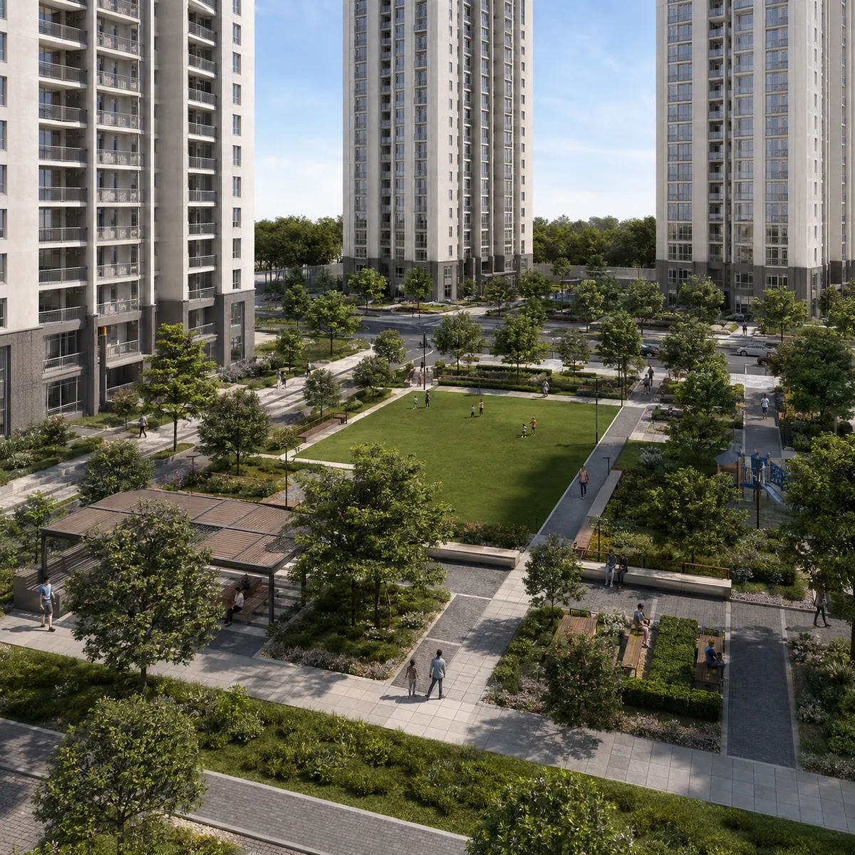
Garden: landscape between six towers, and where the rain goes
What the view shows. The landscape layer between the towers — lawn, planting, walking loops, seating, a play area, the space the render calls open.
What a buyer should look for. Begin with the arithmetic, because it sets the ceiling on what any landscape image can honestly show. Twelve acres is 522,720 sqft. Across about 1,000 homes that is roughly 523 sqft of land per home before the towers, driveways, ramps, clubhouse and services take their share; at the circulating figure of 1,500 homes it falls to about 349 sqft. For comparison, Provident Botanico's 1,275 apartments on 17 acres works out at about 581 sqft a home, and Birla Alokya's 218 villaments on 7.9 acres at about 1,579 sqft — a different product, and here only as a scale reference. This site publishes no open-space percentage, because none exists for this project and inventing one would be worse than saying so.
Then ask where the water goes. The Whitefield belt flooded on 22 May 2026, with arterial roads waterlogged and reporting attributing the repeat events to choked and encroached rajakaluves and to debris dumped into local wetlands. A largely paved 12-acre site sheds water fast. A garden visualisation will never show you a storm drain, so ask for the drawing: where is the stormwater outfall, does a rajakaluve cross or border the parcel, and what buffer is being kept.
Two smaller things are worth looking for in this scene. Whether the green reads as one usable lawn or as decorative strips threaded between buildings — the first is worth several times the second at the same area. And whether any existing tree cover on a village parcel is being retained, which is a question a developer can answer precisely and a render cannot. We publish no tree count.
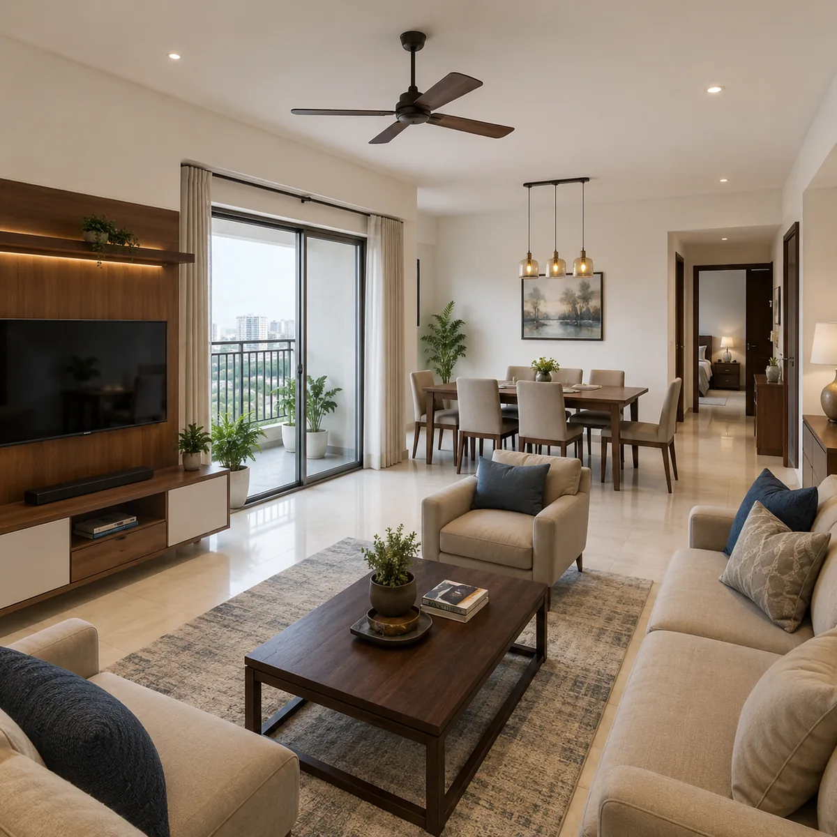
Living room: an indicative three-bedroom interior at about 1,650 sqft
What the view shows. A living and dining space at the scale of the lead configuration — a three-bedroom apartment of roughly 1,650 sqft, with a balcony beyond. Three bedrooms is the corridor's dominant format by a wide margin: the demand panel for this road puts three-bedroom homes at about 85% of all configuration demand, which is why it leads here and why the mix is read as roughly 35% two-bedroom and 65% three-bedroom.
Where that size comes from. It is an estimate, and the working is published rather than hidden. Goyal's own registered apartment product elsewhere in Bengaluru runs from 1,266 to 1,758 sqft across two- and three-bedroom homes, and Provident Botanico on this road runs from 986 to 1,480 sqft. Against those, this site carries an indicative 1,100 to 1,300 sqft for a two-bedroom home and 1,500 to 1,800 sqft for a three, with 1,200 and 1,650 sqft as the central figures. There is no 2.5 BHK and no 4 BHK in this reading; the four-bedroom search on this corridor is villa demand, and this is an apartment project.
What a buyer should look for. Check the furniture against the dimensions, because interior visualisations are routinely built with undersized sofas and beds to make a room read larger. Ask what the quoted area is — super built-up, built-up or carpet — since a 1,650 sqft super built-up figure at ordinary loading is a materially smaller carpet area, and RERA requires carpet area to be disclosed on a registered project. Look at the balcony and ask for its depth in millimetres. Ask for the floor-to-floor and the clear ceiling height, noting that this site publishes no height figures because none is derivable. And ask what is outside the window: at seven homes on a typical plate across six towers, the view from the third floor and from the twenty-second floor are two different apartments at the same price per square foot.
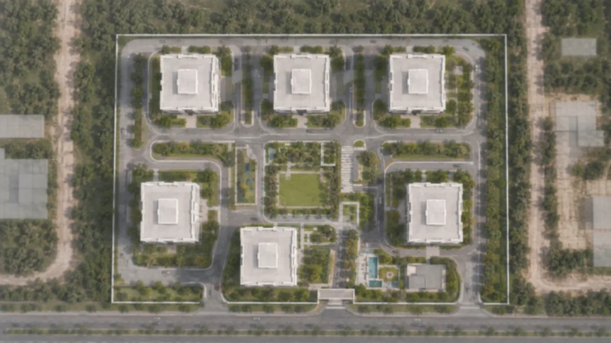
Master plan: the drawing that does not exist
What the view shows. An indicative site layout — towers positioned on the parcel, the clubhouse, the landscape, circulation, the gate.
What a buyer should look for. This is the scene where the honest label matters most. No sanctioned master plan exists for this project. There is no approved drawing, and this parcel is not under BDA or BBMP: it sits in Hoskote taluk, Bengaluru Rural, under the Hoskote Planning Authority, a BMRDA local planning authority. Any layout image is therefore a hypothesis about what 12 acres could carry, not a record of what has been permitted.
The hypothesis is testable in one place, and it is worth stating in this view because nobody else has published it. Twelve acres is 522,720 sqft. At the mix above, the weighted average home is about 1,492.5 sqft, so about 1,000 homes is roughly 1,492,500 sqft of saleable area — a saleable-to-plot ratio of 2.86, implying a floor area ratio near 2.2 once loading and non-FAR areas are allowed for. Read the circulating 1,500 homes literally and the same arithmetic gives 4.28 and an FAR near 3.3. The first is unremarkable for a large group-housing parcel with main-road frontage. The second would sit at the very top of the Bengaluru Development Authority's own base-FAR regime — on a parcel governed by neither BDA nor BBMP. We could not establish the Hoskote Planning Authority's FAR cap for this land, and this page states that as an open question rather than assuming an answer in either direction.
So when a real master plan appears, three checks matter more than the layout's appearance. Which authority sanctioned it and under what plan number. How many homes and how much saleable area it actually carries, which settles the 1,000 against 1,500 question at a stroke. And whether the parcel it describes is a phase or the whole holding, because the group's Soukya Road land is described in channel-partner material as roughly 36 acres, of which the registered villa scheme accounts for about 12.36 — a claim that comes from intermediaries rather than from the developer's own site, and should be read that way.
Soukya Road projects you can actually go and look at
The most valuable images of this corridor are not on this page or any other. They are the buildings already standing on it. Anyone researching Soukya Road projects should spend an afternoon on the road before spending anything else.
Birla Alokya, Thirumalashettihalli. A completed scheme of 218 villaments plus a clubhouse on 7.9 acres, registered as PRM/KA/RERA/1250/304/PR/190724/002725, priced on the developer's own page at Rs 2.15 Cr onwards, with possession having begun in August 2023. It is ready-to-move stock, not a live launch, and Birla Estates itself markets the address as near Hope Farm Junction, Whitefield rather than leading with Soukya Road. Searches for birla alokya soukya road whitefield are the corridor's most common landmark query, and the reason to walk it is simple: it is the only finished large-scheme landscape, clubhouse and boundary treatment on this road that you can judge with your own eyes.
Provident Botanico, Soukya Road. The closest format comparison to what is indicated here — 1,275 apartments in nine high-rise towers on 17 acres, two- and three-bedroom homes of 986 to 1,480 sqft, possession stated from December 2028, registered as PRM/KA/RERA/1250/304/PR/210324/006726 and marketed by Provident Housing of the Puravankara group. Measured from the village node this site publishes it is about 2.5 km east in a straight line and 3.7 km by road, and it is under construction, which means you can see what a nine-tower site on this road looks like mid-build, including how the site handles rain, dust and construction traffic on a two-lane road.
Goyal & Co | Hariyana Group's own registered project on this road. A villa scheme of about 130 to 137 four-bedroom homes on 12.36 acres, registered on 6 February 2025 as PRM/KA/RERA/1250/304/PR/060225/007489. The K-RERA promoter of record on that registration is NIRVANA DEVELOPERS, a string carrying no Goyal or Hariyana token, and the group markets it as Riviera Uno on Soukya Road. It is a different product at a different price, but it is the same developer on the same holding, and its finish, landscape execution and site management are the best available evidence of what this group builds when it builds here.
Two names that circulate alongside it — a "Royale Ville" and an "Orchid Soukya Road" — appear on neither the developer's own portfolio nor anywhere in the Karnataka registry. Do not plan a site visit around them.
What is missing from this gallery, and why
A complete gallery for a launched project would carry a stamped master plan, a floor-plate drawing per configuration, a unit plan with dimensions, an approved elevation, a specification sheet, and photographs of a show apartment. None of those exists for Goyal Soukya Road, and their absence is the most informative thing on this page.
It also carries no image implying work on site, no image implying an approval that has not been granted, and no figure for building height, built-up area, open space, parking bays, clubhouse area, tree count or plant capacity. Those are the numbers that most often enter a project's public record through a caption and then never leave it. Not one of them is derivable from anything we hold, so none appears.
What to verify before you attach any weight to these images
- Ask whether a render is the developer's. For this project, today, the honest answer is that no developer render exists. An image on a third-party page is that page's image.
- Ask for the sanctioned plan and the plan number, and for the authority that issued it — the Hoskote Planning Authority under BMRDA, not BDA and not BBMP.
- Check the Karnataka RERA registration yourself at rera.karnataka.gov.in rather than accepting a screenshot. Confirm it is a project registration in the
PRM/KA/RERA/.../PR/...form and that the promoter string matches the entity you are dealing with. No amount of money should change hands before a number exists. - Ask for carpet area, not just super built-up, on every configuration you are shown.
- Ask which of the towers in a massing image you would actually be buying into, and what its floor plate, lift count and orientation are.
- Re-check the NH-648 status on the day. It is the corridor's biggest variable and it moves.
- Walk the road. Birla Alokya finished, Provident Botanico mid-build, and the group's own villa scheme on the same holding will tell you more in two hours than any gallery can.
When a sanctioned plan and a registration exist, every scene on this page becomes checkable against a document. Until then, read each one as a question about the project rather than a record of it.
Enquire about Goyal Soukya Road
Register a non-binding interest and we will send you the survey numbers, the sanctioned layout, the Hoskote Planning Authority sanction letter and the Karnataka RERA certificate as each one appears. Until they do, we will say so plainly rather than fill the gap with a brochure figure.
Register Your InterestGoyal Soukya Road Gallery – Frequently Asked Questions
Are Goyal Royale Ville, Riviera Apartments and Orchid Soukya Road real, registered projects?
Not on any evidence we could obtain. All three appear in channel-partner copy describing a roughly 36-acre Soukya Road township, and none of the three is on the developer's own portfolio page or anywhere in the Karnataka registry — a case-insensitive search for "royale ville", "riviera apartment" and "orchid soukya" returns zero rows. The source quality behind them is also poor: one of the Royale Ville channel-partner domains now serves content for an unrelated Kanakapura Road project, and another no longer resolves in DNS at all. The "Riviera Apartments" page that comes closest to describing an apartment project states 13 acres and 800 homes, carries no registration number, and self-declares that it is "not an official website". Treat the township as a channel-partner claim, because that is all it has ever been.
Does Cauvery water reach Soukya Road?
No, and the reason is jurisdictional rather than technical. Cauvery Stage V is the scheme that added supply for the "110 villages" brought into BBMP. Those villages are BBMP's; Thirumalashettihalli, Samethanahalli and Koralur are in Hoskote taluk, outside BBMP, so the scheme's boundary does not extend to them. This is not a timing question that resolves in a few years — it is a boundary question that resolves only if the boundary moves. Even inside the scheme delivery is incomplete: by mid-2026 about 104 of the 110 villages were receiving water, with roughly 600 m of a 110.6 km trunk main still unlaid and the Kadugodi ground-level reservoir delayed by land acquisition. Borewell supply with tanker top-up is the realistic base case here. Ask for the borewell yield test and the sanctioned water source in writing, on the approval rather than in a sales conversation.
Does the Soukya Road and Whitefield belt flood?
The access route does, on recent and specific evidence. Bengaluru's flash floods of 22 May 2026 hit Whitefield among the worst-affected areas, with the Whitefield–Hoskote arterial waterlogged, and a separate IMD yellow-alert event on 19 May 2026 flooded Whitefield again. Reporting and resident accounts attribute the repeat pattern to choked and encroached rajakaluves, including construction debris dumped into local wetlands. Those events were concentrated on the Whitefield side rather than on this stretch — but the Whitefield side is the route to work, to school and to hospital from here, so it is not somebody else's problem. Ask where the nearest rajakaluve runs relative to the parcel boundary, ask for the site contour and the storm-water discharge point on the sanctioned plan, and if the timing allows, visit during or right after heavy rain. A dry-season site visit tells you nothing about this.
Can I get an e-khata for a flat in Hoskote taluk?
The e-khata drive most Bengaluru buyers have read about is a BBMP programme, and these parcels are outside BBMP entirely — so it is a different administrative queue with a different issuing body, not the same process at a slower speed. What we could establish is the jurisdiction; what we could not establish is whether a digitised khata has actually been generated for property under this particular local body, and we are not going to assert either way. The practical due-diligence sequence is the same regardless: ask which body issues the khata for this parcel, in what class and in what form; ask whether the record is available digitally today, not in principle; and have your lawyer confirm that the instrument on offer is the one a resale buyer's bank will accept. A record issued by a village-level body is not the same instrument as a city corporation khata, and the difference shows up at resale rather than at booking.
Where exactly is Thirumalashettyhalli, and is it the same place as Samethanahalli?
They are two adjacent revenue villages on the same road, not one place. West to east, Soukya Road passes Channasandra, Thirumalashettyhalli, Koralur, Samethanahalli, Bodana Hosahalli, Kacharakanahalli, Dodda Dunnasandra and Bisanahalli. The parcel described in circulation sits in the Thirumalashettyhalli-to-Samethanahalli stretch, about 2 km in a straight line, and 3.5 km by road, from the SOUKYA holistic health campus at Samethanahalli that gives the road its name — the campus sits north of Soukya Road, which is why the road figure is nearly double the crow-fly one. The spelling varies by source and all three forms are in genuine use: Google Suggest carries Thirumalashettyhalli and Thirumalashettyhally as separate terms, while OpenStreetMap and our structured address fields use Thirumalashettihalli. They are the same village; expect the transliteration to vary between a khata extract, a sale deed and a survey record for the same land.